
Walking a Denton Street by Address
A Denton street directory starts with the location itself. Standardize the street address and unit with USPS, then search the physical address in Denton CAD. Save the returned PID or GEO ID, legal description, subdivision, and situs address. The tax system's owner mailing address is a separate field and can be outside Denton. Next, turn on the parcel layer in CAD GIS, select the tract, and note the map number or R Number, nearby parcel boundaries, and city-limit context.
Use the current parcel identity to reach the County Clerk. The Official Records search can take a grantor or grantee name, subdivision, document type, document number, recorded-date range, and, where indexed, full text. Follow the legal description into the current deed and prior citation. For past households rather than title, move to DPL directory volumes, phone books, newspapers, tax rolls, and maps. The result is a sequence of dated records, not a list of everyone who lives on a street.
- Run the complete address through USPS ZIP Lookup and retain the returned postal ZIP.
- Search Denton CAD by property address and copy the PID, GEO ID, legal description, and situs.
- Open the tract in Denton CAD GIS, activate Parcels, and compare adjacent polygons.
- Search the County Clerk Official Records by legal description and current owner as grantee.
- Check the library's verified directory and newspaper holdings only when the question becomes a dated household trail.
Denton Street Directory Search Fields
The public Denton CAD Property Search is the primary address entry point. Compound Text Search accepts an account number, address, or owner name. Separate controls include Name, Property ID, Owner ID, Geographic ID, Reference ID, Tax Office ID, Property Address, and Advanced Search. The advanced panel adds a street address filter plus subdivision, city, school district, taxing unit, improvement-class, state-code, and market-value choices. Save the result's legal description rather than relying on the street line alone.
| CAD control | Input type | Street-directory use |
|---|---|---|
| Compound Text Search | Text | Account number, address, or owner name |
| Property Address | Text | Portal address search |
| Property ID / GEO ID | Text or numeric | Exact parcel identity or prefix work |
| Street Address | Advanced text filter | Focus a named street |
| Subdivision / city / taxing unit | Advanced fields | Separate similar addresses and boundary context |
Open the CAD search interface to see the live labels and available operators.
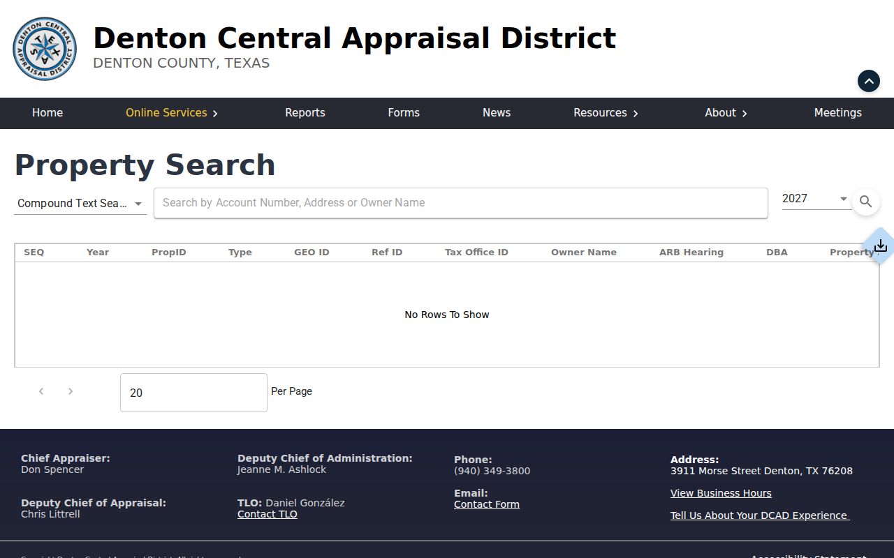
A match supplies parcel facts and an owner-of-record display. It does not identify every household member or prove present occupancy.
Mapping Denton Streets Through GIS
Denton CAD GIS changes a search result into spatial evidence. County procedure directs a researcher to choose Advanced under Find a Property, enter the known information, turn on Parcels under Layers, and click a parcel or use its map number, called the R Number. The service offers parcels, abstracts, city limits, ISD, sales, address, owner, and streets layers. Its public ArcGIS service supports query and identify operations and reports a maximum record count of 2,000.
For a whole block, pan along the road and record each parcel as a separate row. Compare polygon shape, PID or GEO ID, lot and block, subdivision or abstract, and city-limit or school-district layer. Nearby parcels can share a plat, easement, or parent tract without having common current ownership. The parcel map is strongest for map relationships. It is not a survey and does not establish who is physically at an address.
- Parcel
- A mapped land unit in CAD or GIS, usually tied to a property identifier.
- Situs address
- The property's physical location, not necessarily the owner's mailing address.
- Plat
- A recorded map that can establish lots, blocks, streets, and easements.
- Criss-cross directory
- An address-oriented directory; confirm a local volume before treating one as available.
Denton Deeds Behind a Street
The Denton County Official Records Search is the recorded-instrument layer behind the street directory. Quick Search shows the Real Property department, a search term for grantor, grantee, subdivision, document type, or document number, a recorded-date range, and index-only or full-text modes. Start with the legal description or the current owner as grantee. An address-text search may help, but older instruments often index lot, block, subdivision, or metes-and-bounds text more reliably than a modern street number.
Open each likely instrument and capture the grantor and grantee roles, document or instrument number, recording date, execution date where shown, legal description, volume or page, and image or OCR state. Then search the prior instrument cited in the deed. Include plats, easements, releases, correction deeds, liens, probate, and deed-of-trust documents only where the record trail calls for them. A deed names transfer parties; it does not by itself show that either party occupied the property.
Use the official records screen for its current search controls.
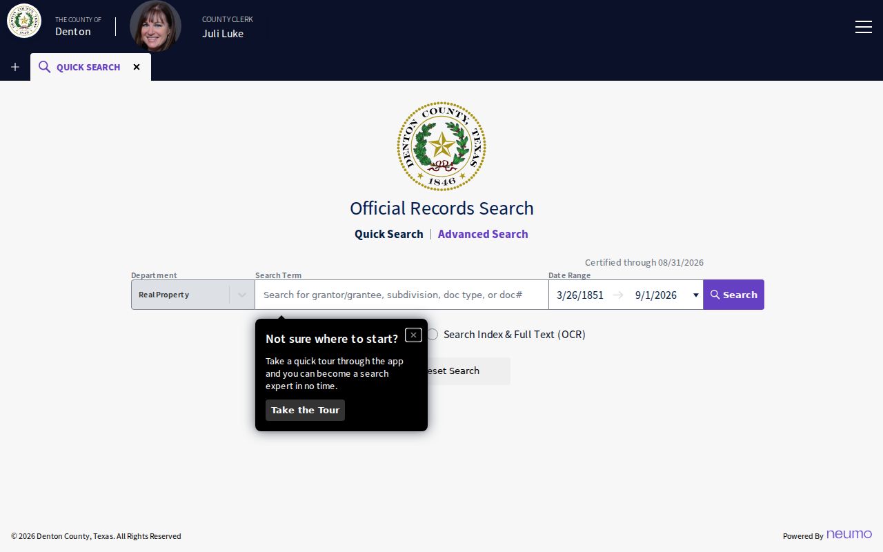
The online index's exact earliest year and image coverage were not located. County guidance reaches into the latter nineteenth century, with microfilm needed for some historical work.
Denton Street Records by Custodian
Several Denton records are keyed to an address, but they answer different questions. Link a CAD PID to an appraisal card, then use its legal description in the County Clerk index. Use the Tax Assessor search to compare an owner mailing address with a property location. City permits and flood files can add building or project context. DPL collections hold historical map, directory, and newspaper layers when a current record does not reach far enough back.
| Denton address record | Custodian | What it can show | Access |
|---|---|---|---|
| CAD appraisal card | Denton CAD | PID, owner display, situs, mailing, legal description, exemptions | Public portal |
| Tax account | Tax Assessor/Collector | Account, owner mailing, property location, inactive and payment status | Public search |
| Deed, plat, lien, easement | County Clerk | Parties, instrument, lot or legal description, recorded date | Index and clerk copy |
| Parcel GIS | Denton CAD | Polygon, map relationship, boundary layers, adjacent parcels | Public viewer |
| Permit or flood record | City Development Services | Address, project or inspection context | eTRAKiT or records request |
For the tax layer, use the Denton County Tax search. Its hints distinguish a property location from an owner's mailing address, and it offers account type, inactive-account, and paid or unpaid status filters.
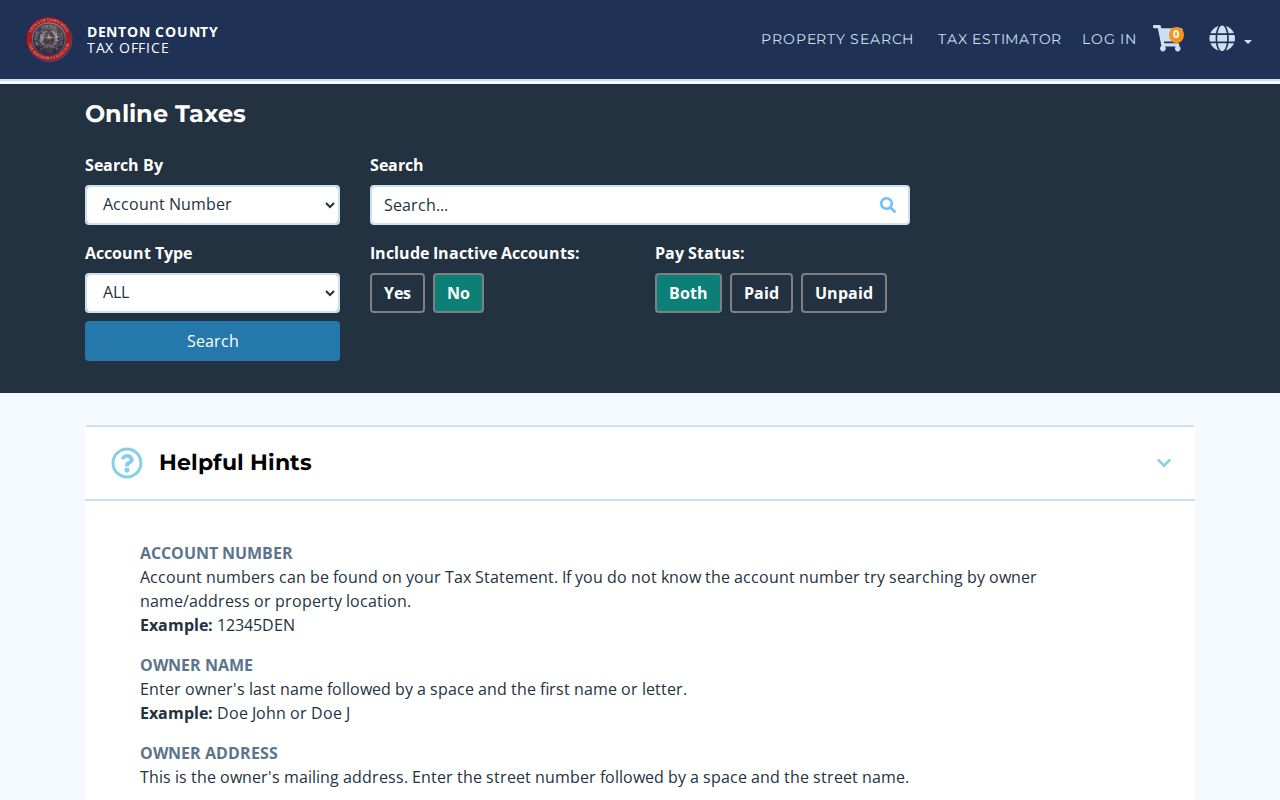
That mailing-versus-situs distinction prevents a common street-search mistake: treating a correspondence address as the parcel location.
Denton Tax Fields Avoid Street Errors
The County Tax Assessor/Collector search is a useful cross-check after a CAD result, but its labels must be read closely. The portal provides Search By and Search fields, Account Type, Include Inactive Accounts, and Pay Status. Its own instructions say an owner-name search uses last name followed by first name or initial. An owner-address search is for the owner's mailing address. A property-location search is the physical street address, with the example omitting street type and direction.
That split is especially valuable when a Denton street directory search returns a matching surname at a different mailing ZIP. Search the physical location to check the parcel account, then compare the CAD situs, GIS polygon, and recorded legal description. Use owner mailing data only as a labeled correspondence clue. It cannot turn a property record into proof that a person lives on the street.
Denton Street Names and Addresses
City addressing supplies another layer for the Denton street directory. The City assigns addresses inside corporate limits, generally after a county-filed plat or by request when a permit needs a separate address. Street-name review checks duplicates, similar sounds, and continuity with adjoining plats. Street and subdivision names are fixed at final plat approval. A dedicated street can be renamed only by City Council ordinance, which creates a record trail for a former name.
The City map is a January 2018 reference map, not a current survey. It shows city limits, ZIP lines, and an address grid, but USPS and the current GIS must confirm an individual address. A former street number can fail in an older index even where a lot, block, survey, abstract, or legal description continues across a rename, replat, subdivision, or annexation.
Review the City Addressing information for the current assignment and street-name route.
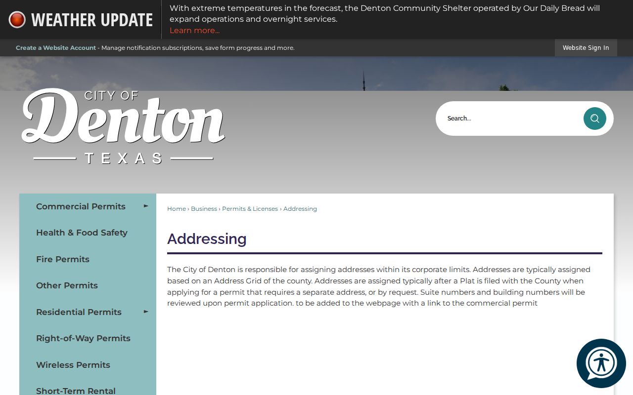
When a historic street name differs from a modern one, save both versions and search council notices, plats, directories, maps, and County Clerk instruments.
Denton Permits Along a Street
Address-keyed City records can provide construction or project context. The Denton eTRAKiT portal offers property, permit, project, contractor, and inspection actions. A named party can be an applicant, contractor, owner, or other project participant rather than an occupant. The City Development Activity page covers approved projects from the last two years, and the permit page is the place to check current service details before visiting an office.
For floodplain or elevation material, the City identifies a request route rather than a general public household index. Code-enforcement records may identify the owner, the most culpable party, or another party with an interest in property. Read the record label and date. A City 311 report may help isolate a location and event date, but the research did not locate a public complete search or retention schedule for that channel.
See the eTRAKiT portal for its live property and permit actions.

Permit data can explain work at an address. It should not be turned into a current-resident list.
Denton Streets Before Modern Maps
Historic street work needs a source ladder. Denton County's 1875 courthouse fire destroyed most county records, which breaks an otherwise simple title search. Texas State Library microfilm identifies deed material beginning in 1854 to 1855 and later 1875 ranges, while Denton Public Library lists tax rolls from 1846 to 1910, deed materials, probate records, telephone books, and local directories. The 1885 Sanborn sheet adds street, lot, and building-footprint context.
Use a present CAD legal description to bridge back into old County Clerk books. Then compare the parcel with 1923, 1929, 1936, or 1939 directory pages, DRC notices, and maps. The library flags a digital newspaper gap around 1981 to 2002, so a web no-match may require microfilm or a library database. The historical volumes themselves belong on the Denton city directory page, not as a substitute for modern address records.
Denton Street Directory Limits
A street directory cannot prove every person who lives on a road. CAD supplies a current owner-of-record display and the tax system may show an owner mailing address. A deed names parties to a transfer. A directory lists a household at the time it was printed. A voter result is a limited registration record. None of these has the same meaning as a current occupancy confirmation. Driver and motor-vehicle personal information is restricted by the DPPA and Texas Transportation Code Chapter 730.
Texas Address Confidentiality Program and voter confidentiality protections can shield addresses for eligible people. Do not attempt to reconstruct a protected residence through a parcel map, a partial search, or historic records. Keep a source date, record type, and custodian with any lawful research note.