
Denton ZIP Code Directory Coverage
Denton's postal geography includes six core city ZIPs, a broader set shown around the City reference map, and several special-facility designations. The City map is useful for orientation, but it is a January 2018 reference rather than a current survey. USPS controls the delivery result for a complete address. The table separates broad official map context from claims about a particular parcel, which must be checked through USPS and current city or county geography.
| ZIP | Areas covered in official context | Post office or postal note | Use in a search |
|---|---|---|---|
| 76201 | Central Denton, downtown, and established city area | Denton delivery grouping | Core city ZIP, verify unit and address |
| 76202 | Denton map and USPS Denton grouping | Exact delivery split not located | Confirm through USPS |
| 76203 | University of North Texas Station | Special facility at UNT Station | Do not assume a standard street parcel |
| 76204 | TWU Station | Special university station | Postal context, not proven residential coverage |
| 76205 | South and central Denton map area | Address-level confirmation required | Core city ZIP |
| 76206 | Golden Triangle Finance Unit | Special finance-unit postal context | Do not infer a household area |
| 76207 | West and north Denton map area | Delivery boundary details not located | Core city ZIP, confirm address |
| 76208 | East and south Denton map area | Postal result controls assignment | City-limit mismatch is possible |
| 76209 | North Denton map area | Denton delivery grouping | Core city ZIP, verify exact address |
| 76210 | South and southeast Denton map area | Nearby-community boundary is possible | Do not equate with city limits |
| 76226, 76227 | Outer north, west, or northeast map context | Exact city coverage not located | Adjacent or overlap area until confirmed |
| 76249, 76258, 76259, 76266 | Outer labels on the City map | Exact post-office coverage not located | Map context only |
The primary city set is 76201, 76205, 76207, 76208, 76209, and 76210. That does not make every address using one of those labels a city-limit address, and it does not make every outer map label part of the city.
Search Denton Records by ZIP
Use a ZIP to narrow geography, then verify the parcel or the record's own address field. The USPS address lookup is the address-level authority. Denton CAD offers address and property filters, although its published advanced-search labels do not show a universal ZIP field. A voter request is different from an individual lookup: the state request form can specify a county, precinct, effective-vote-date range, and selected data fields. TDLR administrative orders have a ZIP-equals filter, but that is an agency record filter, not a people directory.
- Enter the complete street address and unit in USPS, save the returned city, state, ZIP, and lookup date.
- Search Denton CAD and the CAD GIS viewer by address, then compare the situs and parcel geography.
- Check the County Tax Search mailing address separately from the property location. The two fields can carry different ZIPs.
- For a voter question, identify the county and precinct first. For an order question, use the issuing agency's filter and record its status date.
Once a postal area has been narrowed to an actual address, the Denton street directory has the street-level record trail. A ZIP alone cannot identify the parcels or households along a street.
Denton USPS Address Lookup Fields
USPS supplies three modes: By Address, By City and State, and Cities by ZIP. The By Address form accepts Street Address, City, and State, with optional Company, Apt/Suite/Other, and ZIP fields. Its standardized answer does not confirm that a person or company is at the address. It confirms a postal formatting and delivery result, which should be kept separate from the parcel owner, an occupant, or a city-limit conclusion.
| Street address | Required address component for a postal result. Include the house number and street information. |
|---|---|
| City and state | Required location fields in the By Address route. |
| Unit information | Company and Apt/Suite/Other are optional fields that help resolve a delivery point. |
| ZIP field | Optional when searching by address. Use the returned result as the confirmation point. |
The official USPS lookup form is the source shown below.
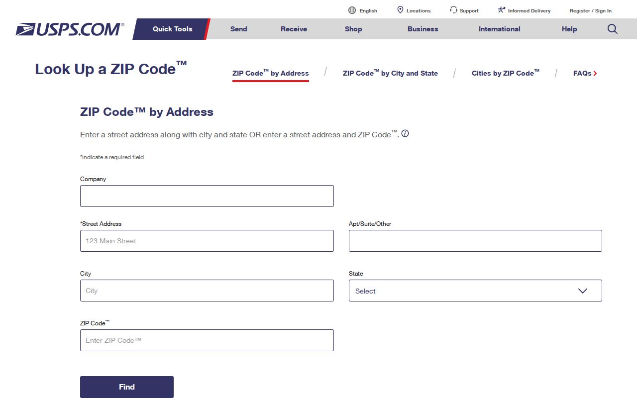
The form is useful before a Denton ZIP code search because it handles the full address and unit, not just a city name or map label.
Denton ZIP Special Facility Clues
Three local labels need extra care. USPS identifies 76203 with University of North Texas Station at 410 Avenue A, 76204 with TWU 1 at 1 TWU Student Building, and 76206 with Golden Triangle Finance Unit at 2101 Colorado Boulevard. Those designations explain postal routing. They should not be presented as ordinary neighborhood boundaries or used to place a household without a street-level USPS and CAD result.
This special-facility pattern is one reason the postal result must be read with the type of address shown. It is a distinctive Denton ZIP code directory issue, not a gap to be filled with a broad city label.
Denton ZIP Map and Addressing
The City of Denton Addressing program assigns addresses inside the corporate limits through the county Address Grid, a filed plat when needed, or a request. Street and subdivision names are fixed at final-plat approval, and a dedicated street rename requires City Council action. Those records matter when an older listing has a former street name or a number that no longer aligns with a modern parcel.
The City Addressing source explains the local address-assignment route used before a ZIP is compared with a parcel.
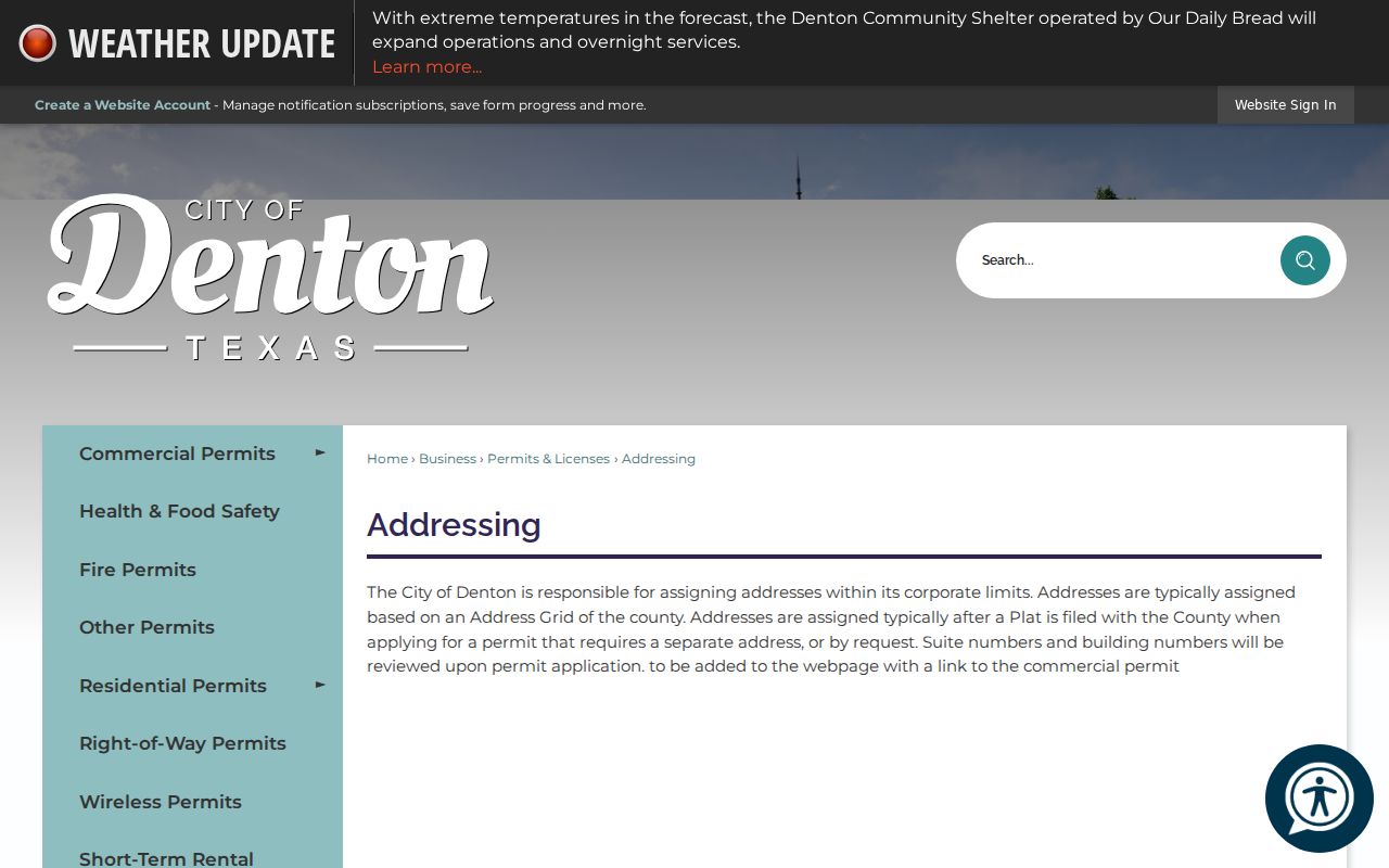
Use the City map for orientation, then confirm the current parcel in GIS. City limits, school districts, county precincts, appraisal geography, and delivery ZIPs are separate layers.
Denton ZIP Code Boundary Limits
A postal label and a municipal boundary do not measure the same thing. The City map includes surrounding geography as well as city limits, which is why it labels more ZIPs than the six most consistent city codes. The City or county GIS can establish the parcel and city-limit context, while USPS establishes the address's postal result. County tax search adds a third fact: its owner mailing address can differ from the property's physical location.
- ZIP and ZIP+4
- A ZIP identifies a broad postal delivery area. ZIP+4 adds a more specific delivery segment to the basic ZIP.
- PO-box ZIP
- A postal designation centered on box delivery, rather than proof of a street-based neighborhood.
- Unique ZIP
- A ZIP associated with one institution or specialized postal operation, such as a university station or finance unit.
- Carrier route
- A postal delivery grouping used to organize mail service. It is not a city-limit or parcel boundary.
Note: Report the postal ZIP, municipal geography, and parcel situs as separate facts whenever a Denton address produces different labels.
Verify a Denton ZIP Code
Resolve a mismatch with a fixed sequence instead of choosing the most familiar label. This is especially important when a Denton postal address is near a city limit, in an extra-territorial area, or associated with a university or finance facility. The three checks below produce separate facts: USPS provides the postal ZIP, GIS provides the municipal and parcel setting, and tax records distinguish the owner's mailing address from the physical property location.
- Run the complete address and unit through USPS, then save the returned city, state, ZIP, and date.
- Find the address in City GIS and Denton CAD. Compare the parcel, city-limit layer, county, school district, and situs field.
- Review the County Tax Search mailing address separately. A mailing ZIP can be outside Denton even when the property is in the city.
- For 76203, 76204, or 76206, check whether the result identifies UNT Station, TWU 1, or Golden Triangle Finance Unit before treating it as a street parcel.
- For 76226, 76227, 76249, 76258, 76259, or 76266, describe the result as adjacent-area or City-map context until the postal and geographic checks agree.
- Keep an old ZIP or former street name with its source date. No official Denton historical realignment or renumbering index was located.
The result is not one blended location label. It is a dated postal answer plus a municipal and parcel answer, each from the office that maintains it.
Denton ZIP Official Filter Routes
Official filters should be used for the precise record they control. The Texas My Voter Portal name route requires a registration ZIP with the name, date of birth, and county, but its normal result is not a full address file. Texas Election Code Section 18.009 restricts use of registration-list information for advertising or promoting commercial products or services. The SOS public-information forms provide a separate, certified route for a scoped file request.
TDLR administrative orders can be filtered by ZIP equal, city, county, license, name, company, or program type. Use it to find an agency order and then preserve its program, record date, and official status. A filter hit does not establish a present Denton address.
Denton ZIP Code Search Care
When a result carries 76203, 76204, or 76206, first check whether it is a special university or finance-unit address. When it carries 76226, 76227, 76249, 76258, 76259, or 76266, describe it as Denton-map or adjacent-area context until the postal and parcel checks agree. No official historic Denton ZIP realignment index was located, so an old ZIP or former street name should remain dated evidence rather than being silently converted.
Three-layer check. Keep the USPS result, City map or city-limit result, and CAD situs or mailing fields in separate notes. Each one describes a different geography.